Annals Of Old Ropley
Ropelia, XII. Century. Roppele and Roppeleghe XIV. Century. Ropeley, XV. Century.
As regards the derivation of the name Ropley, it is described in the Rev. J. B. Johnston's book on "The Place-names of England and Wales" as old English for lea, a meadow, measured by a rope. I like better Mr. Woodhouse's explanation that "Rop" is a corruption or contraction of the name of some Thane who held this Leigh or Ley.
Settlements in the open forest glades where cattle could graze and lie, were called by the Saxons leighs or leys.
The Land Of Flowers
The village of Ropley is on a ridge between the main road from Alresford to Alton and the road to Petersfield. It was much celebrated for its bees, and it is said that William the Conqueror always obtained his honey from this place. This betokens a land of flowers, and indeed I always knew it as such in my childhood's days.
The Pilgrims' Way
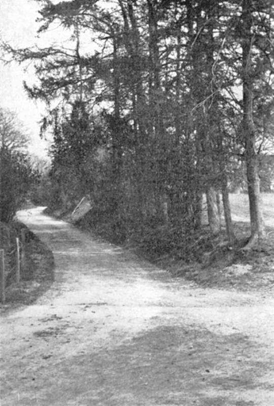
It is not only a local tradition, but would appear to be a matter of certainty that the ancient Pilgrim's Way from Winchester to Canterbury passed through Ropley. How greatly one longs to be able to look back and see the merry cavalcade of Chaucer's Lay ride forth - "A motley company from all parts of the realm, ready to wenden on their Pilgrimage with full devout courage to Canterbury."
After crossing the river Arle at Alresford, the Pilgrims turned north-east along the lane at the back of Bishop Sutton village, till they reached the high road leading through Ropley Dean. After passing the point where now "The Chequers Inn" stands, they struck across some fields to the right and emerged into Brislands Lane, which they followed to the point where it joins that part of the high road known as "The Shrake," which descends towards Chawton.
Some say that the Pilgrims' Way traversed the grounds of Ropley House.
The Pilgrims' Way
Extract From "The Old Road"
By Hilaire Belloc.
By daylight we had come down Whitehill Lane, the steep pitch into Bishop's Sutton, and were tramping it up that vale which makes for the watershed and so leads to the corresponding vale of Alton upon the further side.
Here, at least as far as the Anchor Inn, Ropley, and somewhat further, the modern highway corresponds to the Old Road. It thus follows the lowest of the valley, but there is no reason at first that it should do so. The rise is fairly steady, the ground dry (an insignificant stream gradually disappears beneath the chalk) and the direction points straight to the shortest approach for the ridge which cuts off the basin of the Channel from that of the Thames.
This direction does not, however, long continue. The valley curves somewhat to the north, and it might be presumed that the original way, making more directly for the saddle of the watershed would gradually climb the southern hillside. By doing so it would find two advantages ; it would take a shorter cut, and it would conquer at one stretch, and rapidly, the main part of the 360 feet between the Anchor Inn and the summit.
It was but a guess that the Old Road would probably take a straight line upwards. The curve of the modern road does not carry it more than half a mile from the direct alignment. The Old Road might well have suffered such a deviation, and we were in some doubt when we proceeded to gather our evidence. That evidence, however, proved conclusive.
There is a tradition, which Mrs. Adie has justly recognised, that the pilgrims of the middle ages passed through Ropley. What is more important to our purpose, Ropley has provided a discovery of British antiquities, Celtic torques, near the track which the more direct line to the watershed would presuppose.
We had further the place-name "Street" to guide us : it is a word almost invariably found in connection with a roadway more or less ancient; later on we found many examples of it upon this same road. Here the hamlet of Gilbert Street lay to the north of our hypothetical alignment, and another named North Street, just to the North of it.
We further noted upon our map that a very considerable portion of the exact alignment drawn from the main road at the Anchor Inn to the saddle of the watershed would coincide precisely with a lane, which, when we came to examine it, gave every evidence of high antiquity.
Possessed of such evidence, it was our business to see whether investigation upon the spot would confirm the conclusion to which they pointed. There was enough discovered so to confirm it, though the Old Road at this point has disappeared in several places under the plough.
About half a mile from the "Anchor" at the end of the avenue of trees which here dignifies the turnpike and just after the cross-roads, in a meadow which lay to the right of the road, my companion noticed an embankment, perfectly straight, slightly diverging southward from the main road as the line we were seeking should diverge, and (as we found by standing upon it and taking its direction) pointing directly at the saddle of the watershed. Whether it was continued through the garden of the Chequers Inn (a very few yards) I would not trespass to enquire; in the three fields beyond it had entirely disappeared. After this gap, however, there is a boundary, with an old hedge running along it and a path or cartway of a sort. These carry us in exactly the same direction down a short slope, across a lane called Cow Lane, and on to the Manor Farm at North Street. During this stretch of a mile there was nothing more to guide us. The division between fields and properties very often follows the line of some common way; one could not say more.
But the significant fact which, as we believe, permitted us to bridge the gap was this : That the embankment we had first discovered, and the hedge and path (which proceeded in the same line after the loss of the road over the two fields) each pointed directly towards the lane (Brislands Lane) which we entered close to the Manor Farm, which presented, as we found, such marks of antiquity, which takes the hill steeply, and which, on the plateau above continues to aim straight at the saddle of the watershed.
It is difficult to express in a written description the sentiment of conviction which the actual view of such an alignment conveyed. When we had followed the lane up the steep hill and stood by Brislands Farm house, looking back from that height we could see the lane we had been following, the hedge, the corner of the garden of the "Chequers," the embankment beyond, all in one, stretched out like parti-coloured sections of one string, and the two gaps did not emphasise the exactitude of the line.
Turning again in the direction which we were to follow, the evidence of ancient usage grew clearer.
We were upon one of those abandoned grassy roads, which are found here and there in all parts of England; it ran clear away before us for a couple of miles.
It was very broad - twenty yards perhaps. The hedges stood up on either side, guarding land that had been no man's land since public protection first secured the rude communications of the country. No one who has seen portions of the Icknield Way upon the Chilterns, or of this same Old Road where it has decayed upon the Kentish Hills, could doubt the nature of what we saw. Long fallen into disuse, it had yet escaped the marauding landlords during three centuries of encroachment. They had not even narrowed it. So much of its common character remained : it was treeless, wide, and the most of it neglected ; never metalled during all the one hundred and fifty years which have transformed English highways. It was the most desolate, as it was the most convincing, fragment of the Old Road we had set out to find.
It had an abominable surface ; we had to pick our way from one dry place to another over the enormous ruts which recent carts had made. For generations the lane had been untenanted ; but there is a place where, in the last few years, an extraordinary little town of bungalows and wooden cottages has arisen upon either side of the lane.
Not satisfied with the map, we asked of a man who was carrying milk what local name was given to this venerable street. He told us that the part in which we were walking was called Blackberry Lane, but that it had various names at different parts : and as he could tell us nothing more we left him.
At the very summit this way joined a modern, well-made lane, called Farringdon Lane, turned to the left and north, and immediately fell into the main London Road, which had been climbing from the valley below and was here at the thirteenth milestone.
The Old Road, suffering no deviation, plunged into a wood, and reappeared just at the summit of the pass, perhaps a quarter of a mile further. It is the point where the Ordnance Map marks a height of 683 feet, and where one finally leaves the valley of the Itchen to enter that of the Wey.